Over 3000 articles!
SNLL321 sensor nadir laser plumb line For easy and quick centering on the ground with an accuracy of 1.0 mm at a height of 1.50 m. The built...
View full detailsFor FZ-G1 models with raised corner guards and hand strap. Required to secure the FZ-G1 tablet to the Ruxton Pack. Secures your tablet with...
View full detailsGeoWAN Optical Displacement Sensor Node GeoWAN Optical Displacement Sensor Node is an instrument that uses optical means to take high-precision...
View full detailsFlatMesh Optical Displacement Sensor Node The FlatMesh Optical Displacement Sensor Node is an instrument that uses optical means to take high-p...
View full detailsDJI Zenmuse H20T IP44-rated 640px thermal camera and 20MP zoom camera. Maximum 23x optical zoom + range finder with 1200 m range All the sen...
View full detailsA Lidar + RGB solution for aerial surveying The Zenmuse L1 integrates a Livox Lidar module, a high-precision IMU, and a 1-inch CMOS camera on a ...
View full detailsThe new benchmark for aviation measurement The Zenmuse P1 integrates a full-frame sensor with interchangeable fixed-focus lenses on a 3-axis st...
View full detailsGeoWAN 4G Gateway Where a geotechnical or structural monitoring solution is required to cover a large area, such as a mine or a city, we typica...
View full detailsGVP647 Mini Backpack GS10 GNSS Receiver The Leica GVP647 Mini Backpack for GS10 Receivers allows you to carry a GNSS receiver and RT...
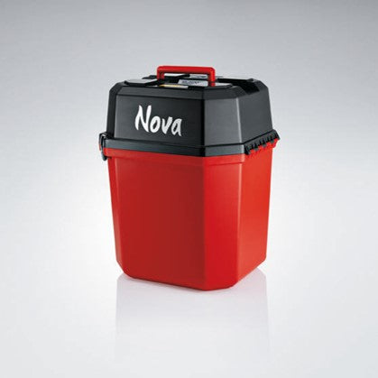
View full detailsLeica GVP727 Total Station Case - Red Total station case for Leica MS50 and MS60 MultiStations
Leica GVP725 Hard Case - Red GVP725 Hard case for TS16 Total station
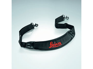
Leica GVP719 Shoulder strap Leica GVP719 shoulder strap for large instrument containers GVP721/722/723/725, e.g. for the TS16 total station
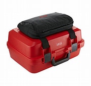
Leica GVP717 Side case for total stations The side bag for the Leica GVP hard case is a robust side container that holds tablets, laptops or do...
View full detailsLeica MCF256 256MB Compact Flash Card for GPS/TPS-733257 Losing data due to faulty storage media is frustrating and costly. Leica'...
View full detailsLeica GEB63 Battery Box Battery box for eyepiece and eyepiece lamp for automatic cooling. Leica GOA2 Autocollimation eyepiece and 394787 GEB...
View full detailsLeica GEB62 Plug-in lamp Cable for eyepiece for automatic coordinate animation. The Leica GOA2 Autocollimation eyepiece and 394792 GEB63 Bat...
View full detailsLeica GFZ3 Diagonal eyepiece For comfortable observation of steep sights, up to the zenith. Fits all Leica total station instruments except TS0...
View full detailsWith the capacity to store up to 1 GB of data, the Leica MCF1000 Compact Flash Card is the perfect choice for use with your GPS/TPS1200. Th...
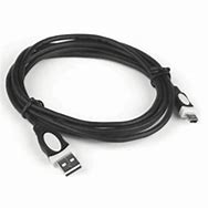
View full detailsLeica GEV223 Data cable USB to mini-USB 1.8m GEV223, Data Transfer Cable, USB Host to USB Mini, 1.8m. Connects TS02/06/09 with Communication Si...
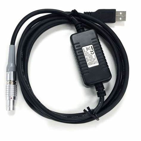
View full detailsLeica GEV267 data transfer cable 2.0 m USB A to Lemo 5-pin. Connects Leica Viva total stations and digital levels of the DNA and TPS series ...
View full detailsLeica GEV269 Data transfer cable USB – 2 m GEV 269, Data transfer cable, conversion cable Lemo to USB A connector, 2.0 m, connects GNSS receive...
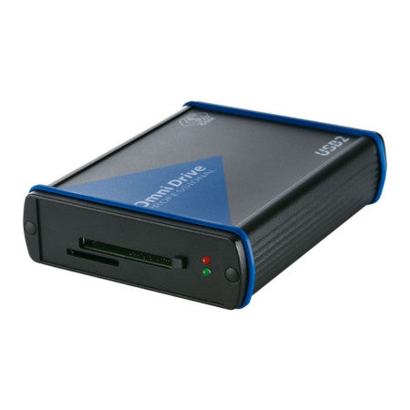
View full detailsMCR7 SD/CF USB card reader Secure data transfers with USB connection to all PC operating systems. MCR7: for SD and CF cards. MCR8: for ...
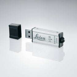
View full detailsMS1 USB flash drive 1GB This Leica-765199 MS1 industrial grade USB flash drive is designed with a capacity of 1GB to accommodate your d...
View full detailsLeica MSD08 8GB industrial grade SD memory card This rugged, industrial-grade SD card features 8GB of memory to securely store your data. The M...
View full details